[Home]

[Volume 1-2]

SWMU Building 43 Links

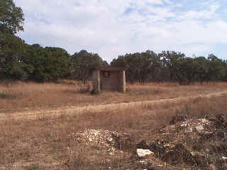
SWMU Bldg 43 View Facing East - January 1999

Site Status: Closed (August 2005)

Background

Description in Current Conditions Report (July 1999)

Chronology

Aerial Photograph

Figure B43-1 Plan View Map

Additional Site Photograph

Plans (Volume 1-2)

RL17 RFI Work Plan (February 1996)

RL53 Work Plan Addendum (May 2000)

TO0019 Work Plan Addendum (December 2003)

Investigation Reports (Volume 3-1)

List of Previous Investigation Reports

RCRA Facility Investigation Report (December 2002)

RCRA Facility Investigation Report Addendum (June 2003)

Closure Report (April 2005)

Tables

Table Building 43-1   Summary of Chemical Constituents Detected in Soil Gas (August 1996)

Table Building 43-2   Summary of Chemical Constituents Detected in Soil (February 2000)

Table Building 43-3   Summary of Chemical Constituents Detected in Wipe Samples

Table Building 43-4   Summary of Chemical Constituents Detected in Soils (March 2003)

Figures

Figure Building 43-1   Site Location Map 

Figure Building 43-2   Soils and Topographic Map 

Figure Building 43-3   Geologic Setting

Figure Building 43-4   Sample Location Map 

Figure Building 43-5   In-Phase Electromagnetic Data 

Figure Building 43-6   Quadrature Phase Electromagnetic Data

Figure Building 43-7   SWMU Building 43 Historical Aerial Photographs

Figure Building 43-8   Surface Soil Sample Location Map

Boring Logs

Building 43 SB1-SB6 (February and March 2000)