[Home]

[Volume 1-2]

SWMU B-28 Links

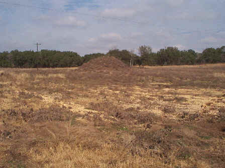
SWMU B-28 View Facing Northeast - January 1999

Site Status: Closed (November 2011)

Background

Description in Current Conditions Report (July 1999)

Chronology

Aerial Photograph

Figure B28-1 Plan View Map

Plans (Volume 1-2)

RL33 RFI Work Plan (June 1997)

RL83 Interim Measures Work Plan (May 2000)

RL33 Work Plan Amendment for Data Quality Rework (May 2000)

Final Storm Water Pollution Prevention Plan (November 2010)

Investigation Reports (Volume 3-1)

Section 8, Technical Memorandum on Surface Geophysical Surveys, Well 16 Source Characterization (June 1995)

Section 8, Technical Memorandum on Soil Boring Investigation (June 1995)

Addendum to Technical Memorandum on Soil Boring Investigation (August 1995)

Section 6, Technical Memorandum on Soil Gas Surveys (June 1996)

RCRA Facility Investigation Report (April 2002)

SWMU B-28 Release Investigation Report (August 2011)

Tables

Table B28-1  Chemical Constituents Detected in Soil (February 1995)

Table B28-2  Chemical Constituents Detected in Groundwater (March 1995)

Figures

Analytical Results Map (February 1995)

Geophysical Anomaly Map (June 1995)

Figure B28-1  Site Location Map (April 2002)

Figure B28-2  Soils and Topographic Map (April 2002)

Figure B28-3  Geologic Setting (April 2002)

Figure B28-4  Sample Location Map (April 2002)

Boring Logs

B28-SB1 (March 1995)

B28-SB2 (March 1995)

B28-SB3 (March 1995)

B28-SB4 (March 1995)

B28-SB5 (March 1995)

B28-SB6 (March 1995)