[Home]

[Volume 1-2]

SWMU B-24 Links

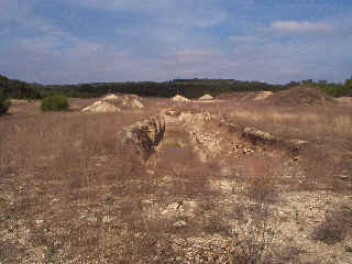
SWMU B-24 View Facing Northeast - January 1999

Site Status: Active Range

Background

Description in Current Conditions Report (July 1999)

Chronology

Aerial Photograph

Figure B24-1 Plan View Map

Additional Photographs

Plans (Volume 1-2)

RL33 RFI Work Plan (May 2000)

RL83 Interim Measures Work Plan (May 2000)

RL33 Work Plan Amendment for Data Quality Rework (May 2000)

Final Geophysical Surveys Work Plan - Addendum, SWMU B-20 and SWMU B-24

Work Plan Addendum for the Overage Pile (February 2011)

Investigation Reports (Volume 3-1)

Final RCRA Facility Investigation Report (May 2002)

Section 9 of Technical Memorandum on Geophysical Surveys (October 1995)

Tables

Table B24-1   Summary of Chemical Constituents Detected in Soil (March 2000)

Table B24-2   Summary of Metals Levels above Background in Sifted Soil

Table B24-3   Summary of Chemical Constituents Detected in Sifted Soils (March and April 2000)

Figures

Geophysical Anomaly Map

Figure B24-1   Site Location Map

Figure B24-2   Soils and Topographic Map

Figure B24-3   Geologic Setting

Figure B24-4   Sample Location Map

Boring Logs

B24-SB1 through B24-SB5 (March 2000)