Offsite Well Survey - August 2001
Appendix C - Photographic Documentation
Figure 1. Well 2 (CS-2) located at CSSA. Well is currently used for groundwater monitoring, and is fitted with a dedicated bladder pump.
Photograph by S. Pearson facing north. September 1999.
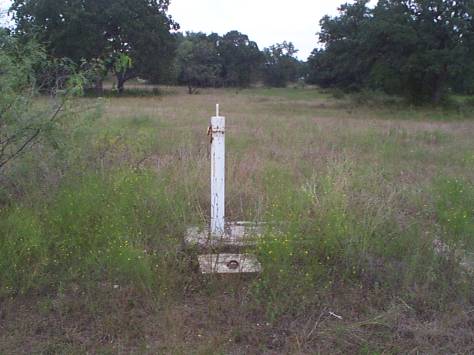
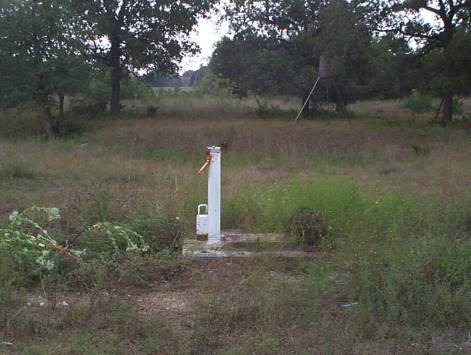
Figure 2. Well 3 (CS-3) located in the south pasture at CSSA. Well is currently used for monitoring groundwater levels only.
Photograph by S. Pearson facing north. September 1999.
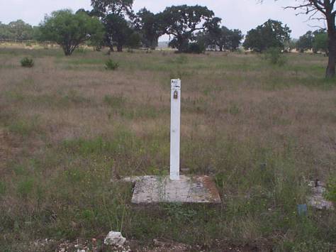
Figure 3. Well 4 (CS-4) located in the south pasture at CSSA. Well is currently used for monitoring groundwater levels only.
Photograph by S. Pearson facing northeast. September 1999.
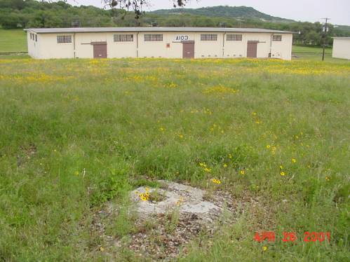
Figure 4. Location of abandoned Well 5 (CS-5) in the west-central portion of the inner cantonment at CSSA. This stock well was plugged on September 29, 1994.
Photograph by S. Pearson facing east. April 2001.
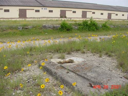
Figure 5. Location of abandoned Well 6 (CS-6) in the southwest corner of the inner cantonment at CSSA. This stock well was plugged on September 29, 1994.
Photograph by S. Pearson facing southeast. April 2001.
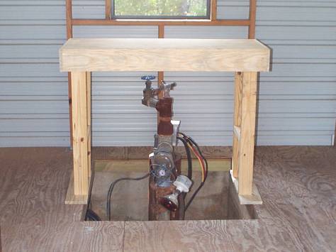
Figure 6. Well 9 (CS-9) located near the top of McFarland Hill near the western perimeter fenceline at CSSA. Well is currently used as a water supply source for CSSA.
Photograph by S. Pearson. September 1999.
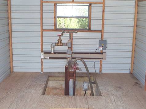
Figure 7. Well 10 (CS-10) located near the top of McFarland Hill near the western perimeter fenceline at CSSA. Well is currently used as a water supply source for CSSA.
Photograph by S. Pearson. September 1999.
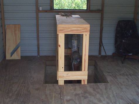
Figure 8. Well 11 (CS-11) located near the top of McFarland Hill near the western perimeter fenceline at CSSA. Well is currently an inactive water supply source for CSSA. Photograph by S. Pearson. September 1999.
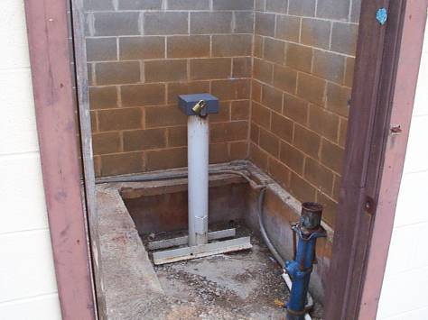
Figure 9. Well 16 (CS-16) located at the northern edge of the inner cantonment area fenceline at CSSA. The well is currently used for groundwater monitoring and observation, and is outfitted with dedicated downhole sampling pump and level transducer.
Photograph by S. Pearson facing east. September 1999.
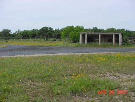
Figure 10. Former location of abandoned Well A (CS-A), northern edge of the inner cantonment area fenceline at CSSA. This was a former stock well; no data regarding this well are available.
Photograph by S. Pearson facing north. April 2001.
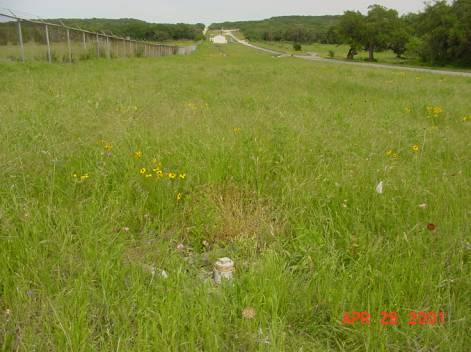
Figure 11. Former location of abandoned Well B (CS-B), northern edge of the inner cantonment area fenceline at CSSA. This was a former stock well; no data regarding this well are available.
Photograph by S. Pearson facing east. April 2001.
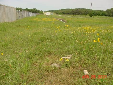
Figure 12. Former location of abandoned Well C (CS-C), northern edge of the inner cantonment area fenceline at CSSA. This was a former stock well; no data regarding this well are available.
Photograph by S. Pearson facing east. April 2001.
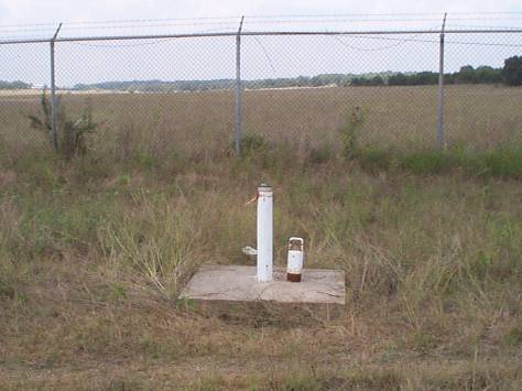
Figure 13. Well D (CS-D) located at the northern edge of the inner cantonment area fenceline at CSSA. The well is currently used for groundwater monitoring and observation, and is outfitted with a dedicated downhole sampling pump.
Photograph by S. Pearson facing north. September 1999.
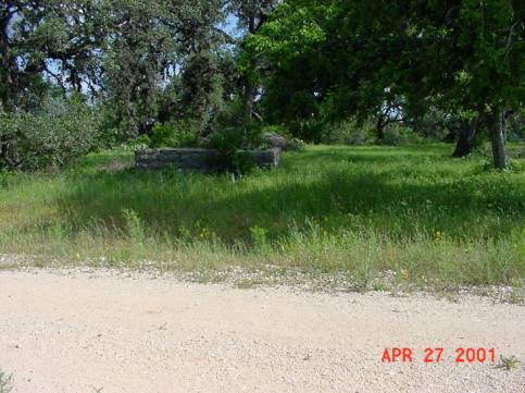
Figure 14. Former location of abandoned Well E (CS-E), southern portion of the north pasture at CSSA. This was a former stock well; no data regarding this well are available.
Photograph by S. Pearson facing east. April 2001.
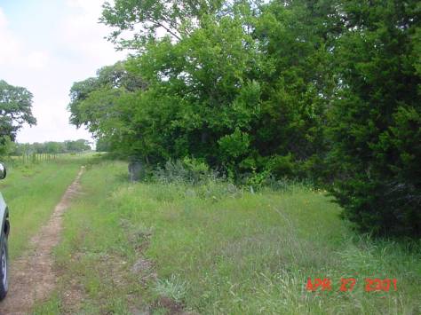
Figure 15. Former location of abandoned Well F (CS-F), central portion of the north pasture at CSSA. This was a former stock well; no data regarding this well are available.
Photograph by S. Pearson facing north. April 2001.
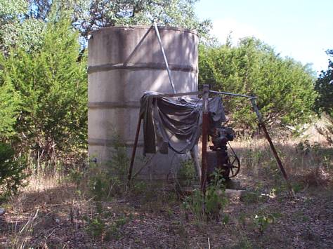
Figure 16. Well G (CS-G) located in the central portion of the north pasture of CSSA. This agricultural well is owned by the USDA, but is for the most part inactive. This well is sampled quarterly as part of the monitoring program.
Photograph by S. Pearson facing northeast. September 1999.
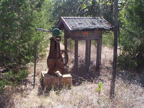
Figure 17. Well H (CS-H) located in the northwest quadrant of CSSA. This agricultural well is owned by the USDA, but is inactive due to pump damage.
Photograph by S. Pearson facing east. September 1999.
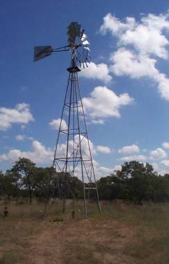
Figure 18. Well I (CS-I) located in the northeast quadrant of CSSA. This agricultural well is owned by the USDA, and is currently operated to maintain the level of a nearby stock tank.
Photograph by S. Pearson facing north. September 1999.
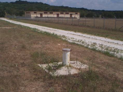
Figure 19. Well MW1 (CS-MW1) located between the south pasture and the H&I Area in the central portion of CSSA. This well is exclusively for groundwater monitoring and observation, and is equipped with a dedicated sampling pump.
Photograph by S. Pearson facing southeast. September 1999.
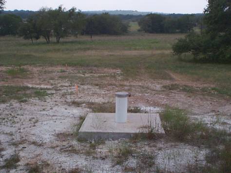
Figure 20. Well MW2 (CS-MW2) located west of the H&I Area in the central portion of CSSA. This well is exclusively for groundwater monitoring and observation, and is equipped with a dedicated sampling pump.
Photograph by S. Pearson facing southwest. September 1999.
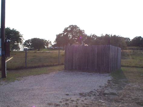
Figure 21. Municipal supply well Fair Oaks #8 (FO-8) located off Ralph Fair Road (west of CSSA). This location typifies the wellhead and right-away access for municipal wells operated by Fairco Water Company.
Photograph by S. Pearson facing west. September 1999.
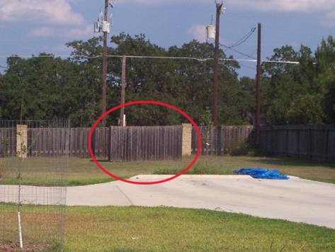
Figure 22. Municipal supply well Fair Oaks #14 (FO-14) located off Ralph Fair Road (northwest of CSSA). This well is one of several that are sited at developed homestead properties. Fairco gains access to the wellhead from Ralph Fair Road. Photograph by S. Pearson facing east. September 1999.
Figure 23. Municipal supply well Fair Oaks #17 (FO-17) located off Old Fredericksburg Road. This location is a satellite property away from Fair Oaks Ranch proper.
Photograph by S. Pearson facing south. September 1999.
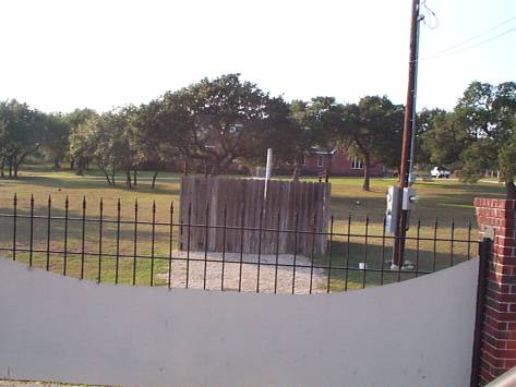
Figure 24. Municipal supply well Fair Oaks #22 (FO-22) located off Ralph Fair Road (west of CSSA). This location is typical of wells operated by Fairco Water Company within private property boundaries.
Photograph by S. Pearson facing west. September 1999.
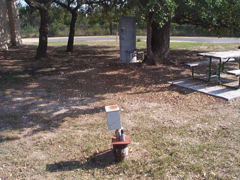
Figure 25. Wellhead and pressure vessel located outside the Fair Oaks Exxon (RFR-1) at the corner of Ralph Fair Road and Deitz-Elkhorn.
Photograph by S. Pearson facing southeast. September 1999.
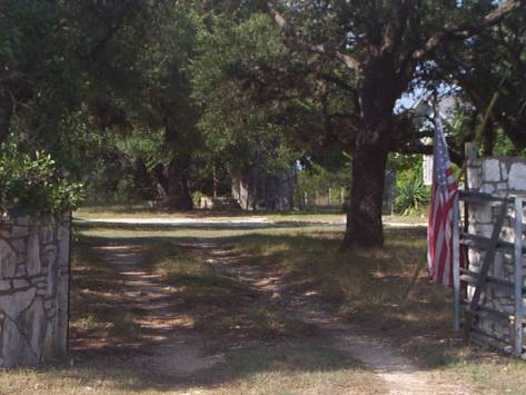
Figure 26. Windmill and cistern located outside northwest corner of CSSA at well location RFR-2. No record of this well was located within the state database, and its operational status is unknown.
Photograph by S. Pearson facing north. September 1999.
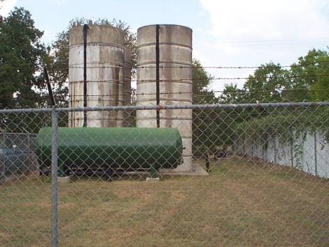
Figure 27. LS-1 wellhead and pressure system operated by Bexar-Met in Leon Springs Villa. The CSSA security fenceline bounds this location at the rear of the photo.
Photograph by S. Pearson facing northwest. September 1999.
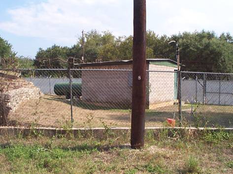
Figure 28. LS-2 wellhead and pressure system operated by Bexar-Met in Leon Springs Villa. This location bounds the southwest corner of CSSA.
Photograph by S. Pearson facing southeast. September 1999.
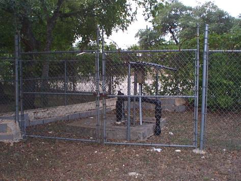
Figure 29. LS-3 wellhead owned by Bexar-Met in Leon Springs Villa. This location is in the immediate vicinity of LS-2, LS-5, LS-6, and LS-7 at the southwest corner of CSSA, and is currently inactive.
Photograph by S. Pearson facing south. September 1999.
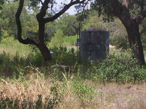
Figure 30. LS-5 wellhead and cistern located off Curres Creek Road near the southwest corner of CSSA. This well is located on the vacant lot between LS-6 and LS-7. The operational status of this well is unknown.
Photograph by S. Pearson facing northwest. September 1999.
Figure 31. LS-6 wellhead and cistern (in background of photo) located off Curres Creek Road near the southwest corner of CSSA.
Photograph by S. Pearson facing north. September 1999.
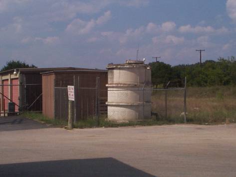
Figure 32. RFR-12 wellhead and cistern located behind Diamond Shamrock fueling station.
Photograph by S. Pearson facing northwest. September 1999.
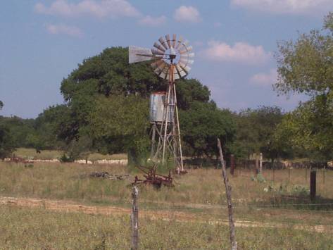
Figure 33. OFR-1 windmill and cistern located off Old Fredericksburg Road.
Photograph by S. Pearson facing north. September 1999.